
As a geography teacher, I start with a simple question: where is norway on a map? By looking at coastlines, fjords, and neighbors, students build spatial sense through hands-on exploration. This article offers a beginner-friendly approach to map literacy in class.
To build lasting map literacy, we start with clear goals and concrete steps. Students first locate Norway within a blank European map, then discuss its position in Scandinavia and along the North Sea. We move from recognition to reasoning by using printable maps and simple color codes for regions, coastlines, and major cities. The goal is curiosity plus a basic toolkit for geographic thinking.
Learning goals
Learning objectives: by the end of the unit, students will identify Norway on a map of Europe, describe its regional context, and name neighboring countries. They will interpret simple map features such as coastlines, fjords, and bodies of water, and explain the roles of legends and scale. Students will demonstrate how location shapes culture, climate, and everyday life in a country.
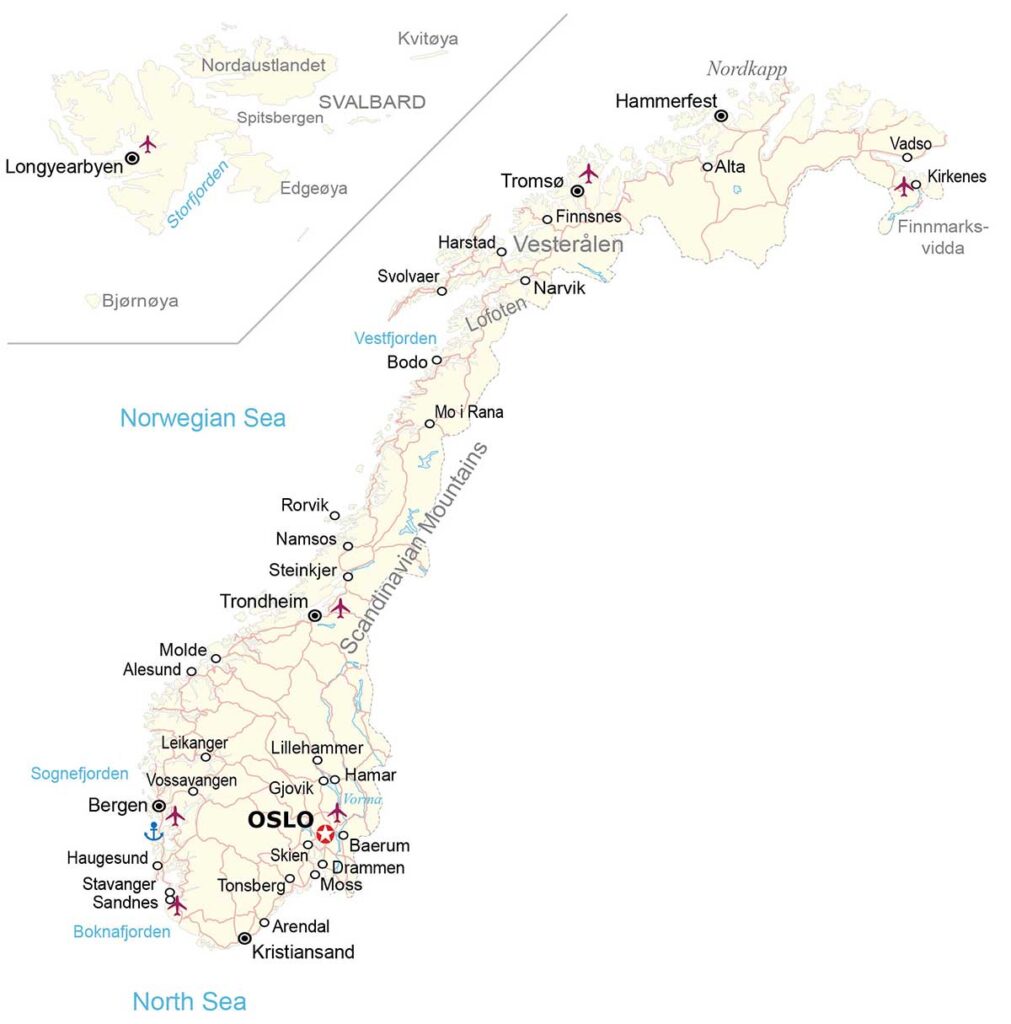
Classroom activities: begin with a blank map of Europe or a labeled map showing Norway and surrounding nations. Students practice tracing coastlines, labeling regions, and marking cities with a color code. Next, they compare a map template in portrait and landscape orientation to see how layout affects readability. A short reflection prompt helps connect geography to current events.
Materials and tools
Age-appropriate use: younger students focus on location, region, and basic spatial vocabulary using simple labels and pins. Older students tackle map scales, distance, and relative location, using organizer sheets and guided questions. Teachers can scaffold with sentence starters like 'Norway is north of' or 'Norway borders' to support discussion.
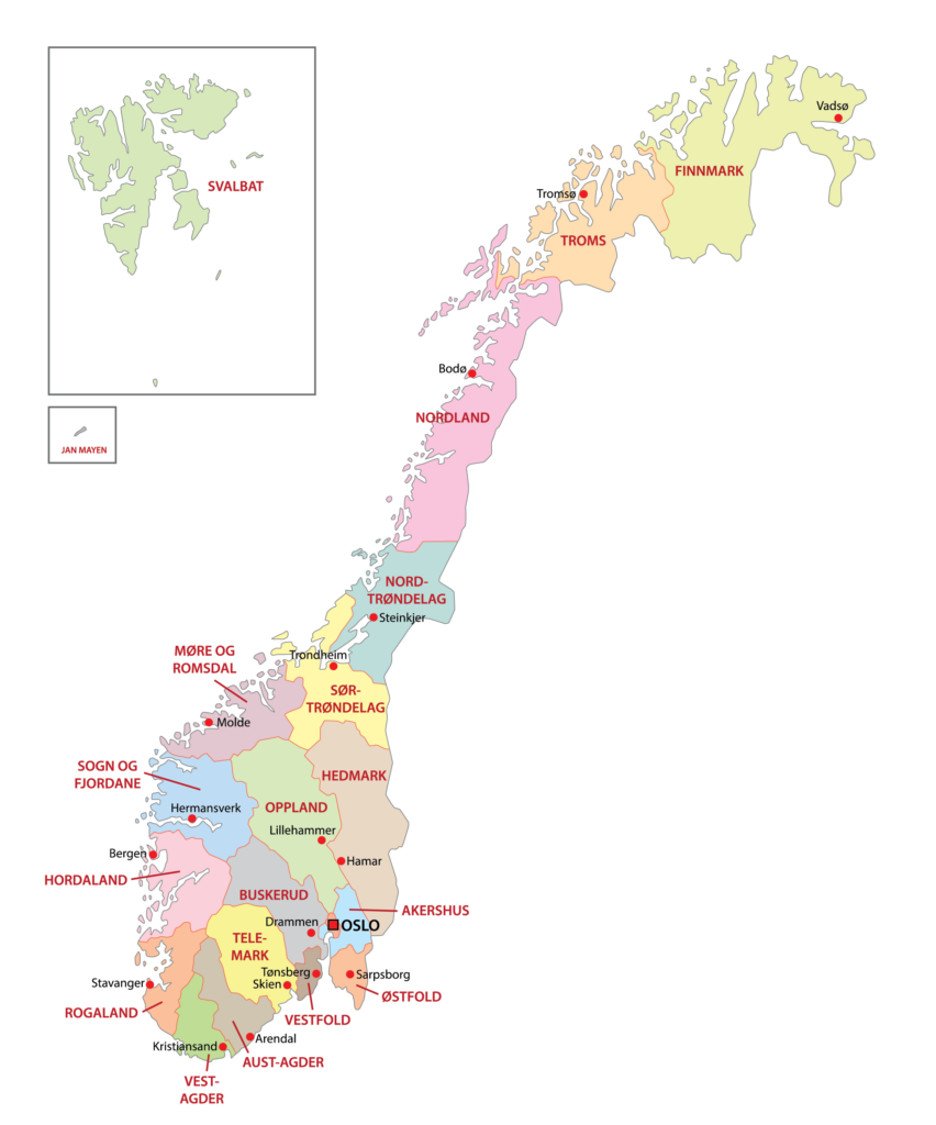
Assessment and differentiation: check for accurate labeling, proper orientation, and the ability to describe geographic context. Provide tiered tasks: blank maps for beginners and more detailed labels for advanced learners. Use quick exit tickets, rubrics, and peer feedback to monitor progress and adjust instruction.
Printing tips
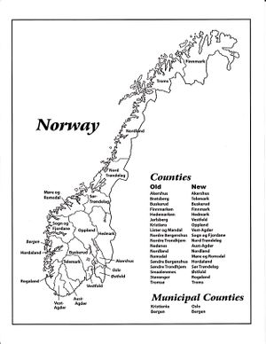
Q: How should I print a printable map for students? A: Print in landscape orientation on standard Letter or A4 paper, set margins to about 0.5 inches, and ensure the labels remain readable. Q: Which map type should we start with for beginners? A: Begin with a blank map or an outline that includes country names to build confidence before moving to a labeled map.
Q: How can teachers help students understand Norway's location relative to neighbors? A: Use a labeled map that shows Sweden, Finland, Russia, and Denmark, and prompt students to describe the directional relationships. Q: How do I check the printed result for accuracy? A: Compare it to the on-screen map, verify legible fonts, intact margins, and correct orientation before students proceed.
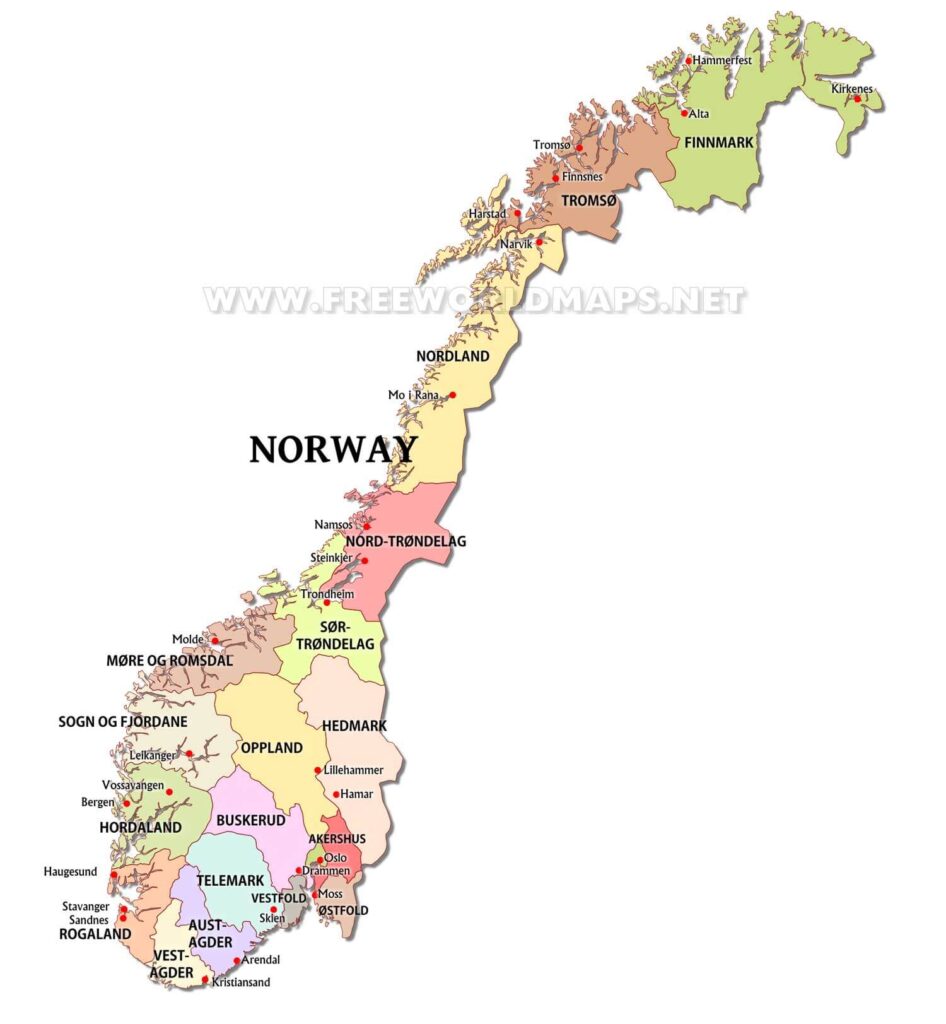
Conclusion: This beginner-friendly approach to teaching Norway on a map emphasizes step-by-step skill-building, not memorization. Start with a blank or outline map to locate place, then switch to a printable or labeled map to reinforce features such as coastlines and fjords. Provide age-appropriate tasks, clear objectives, and simple checks for understanding. With thoughtful printing settings and guided discussion, students gain confidence in map literacy and geographic thinking that they can transfer to other regions.